Historically, the upper portion of the watershed was primarily used for ranching and timber. These land uses remain in effect today, albeit to a lesser degree.
While much of the upper section of the watershed is privately owned, the state owns part of it, which resides in the Bothe Napa Valley State Park. Additionally, Sonoma County has acquired 1,192 acres. Currently unopened to the public, the acreage will become a new regional park, Mark West Creek Regional Park and Open Space Preserve.
Other notable locations include the wildlife preserve Safari West, the Pepperwood Preserve, the Mayacamas Golf Club, and Rancho Mark West.
Historically, the lower portion of the watershed initially farmed row crops, hops, and prune and apple orchards.
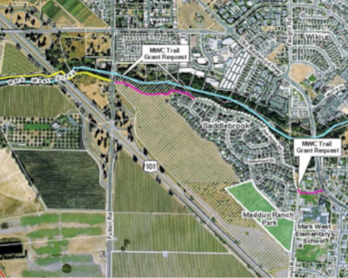
Now, a portion of the lower creek is highly urbanized, characterized by the Larkfield-Wikiup and Riebli-Wallace neighborhoods. It extends east of Highway One to the Sonoma County Airport and Airport Business Center west of the highway. Due to heavy urbanization and industrialization, the lower section of the creek could experience additional contamination.
Further west, the landscape is predominantly utilized by rural residential areas and for vineyards, wineries, and other agricultural purposes.